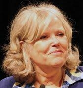
Jerry Jacobs, Jr.
CEO, Delaware North
Jeremy “Jerry” M. Jacobs, Jr. is Chief Executive Officer of Delaware North and an alternate governor to the Boston Bruins of the National Hockey League (NHL). He shares the CEO and alternate governor titles with his brothers, Lou and Charlie Jacobs.
Delaware North is a family-owned global leader in hospitality, with operations in food and retail at airports and sports venues, hospitality services at parks and major tourist attractions, hotel ownership and management, gaming operations, fine dining and catering, and sports facility ownership and management. In 1995, Delaware North built a new multi-purpose arena in Boston, Mass., that is currently home of the Bruins and the Boston Celtics of the National Basketball Association (NBA). Over the past 25 years, the TD Garden has undergone many transformations and is now considered one of the most innovative and celebrated venues in North America.
Delaware North maintains a global headquarters in Buffalo, N.Y. where the Jacobses are celebrated as longtime supporters of the University at Buffalo, a flagship institution in the State University of New York system. The university named and dedicated the Jacobs School of Medicine and Biomedical Sciences in 2015, in recognition of the Jacobs family’s many decades of philanthropy. Most recently, the Jacobs family contributed $30 million for the construction of the new, state-of-the-art medical school building in downtown Buffalo. The Jacobses also founded the Jacobs Institute, a medical innovation center focused on accelerating device development in vascular medicine.
The Jacobs family and Delaware North are significant benefactors to multiple non-profit organizations in Western New York and throughout the United States and world. Jerry serves on the Scholarship Board for Say Yes Buffalo, an organization dedicated to increasing high school and postsecondary completion rates for students in the City of Buffalo. He is a past member of Georgetown University’s Board of Regents and volunteers as an alumnus interviewer.
Jerry has additionally dedicated more than two decades of volunteer service to the United Way of Buffalo and Erie County, including past chairmanships of the organization’s board of directors and annual fundraising campaign, and is a past chair of the Nichols School’s Board of Trustees, where he founded the Jacobs Scholars program for high-achieving students with financial need.
Jerry is active in multiple business and civic organizations. He completed a term on the U.S. Department of Commerce’s Travel and Tourism Advisory Board in 2015, and in 2018 he was named to the U.S. Secretary of Interior’s “Made in America” Outdoor Recreation Advisory Committee. He is an active member of the U.S. Travel Association’s CEO Roundtable and the Partnership for New York City.
Jerry completed an M.B.A. from the Wharton School of Business at the University of Pennsylvania and a B.A. from Georgetown University. He met his wife, Alice Jacobs, when they were both students at the University of Pennsylvania, where she earned a J.D. Alice is the chair emerita of the Western New York Women’s Foundation, president of the Albright-Knox Art Gallery Board of Directors, and a member of the board of directors for the Community Foundation for Greater Buffalo.
Jerry and Alice reside in East Aurora, New York. They have two children, Melissa and Justin.


